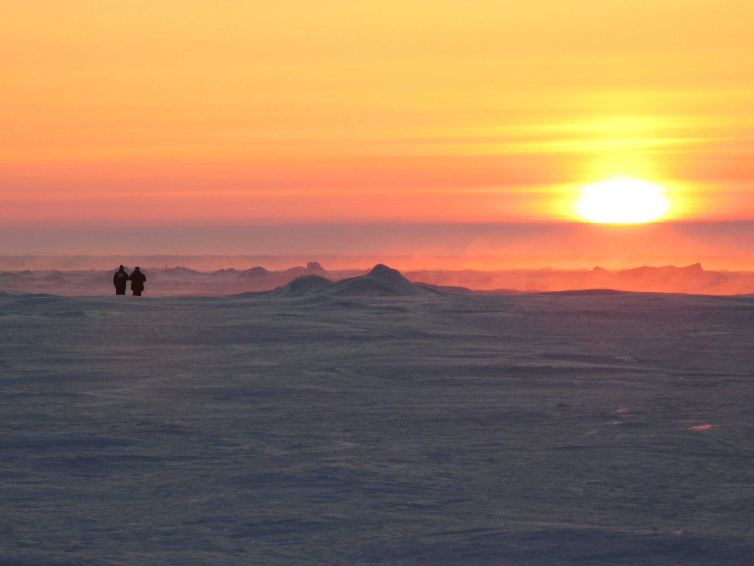
Earth’s rapidly changing Arctic coastal regions have an outsized climatic effect that echoes around the globe. Tracking processes behind this evolution is a daunting task even for the best scientists.
Coastlines are some of the planet’s most dynamic areas – places where marine, terrestrial, atmospheric and human actions meet. But the Arctic coastal regions face the most troubling issues from human-caused climate change from increasing greenhouse gas emissions, says Los Alamos National Laboratory (LANL) scientist Andrew Roberts.
“Arctic coastal systems are very fragile,” says Roberts, who leads the high-performance computing systems element of a broader Department of Energy (DOE) Office of Science effort, led by its Biological and Environmental Research (BER) office, to simulate changing Arctic coastal conditions. “Until the last several decades, thick, perennial Arctic sea ice appears to have been generally stable. Now, warming temperatures are causing it to melt.”
In the 1980s, multiyear ice at least four years old accounted for more than 30 percent of Arctic coverage; that has shrunk to not much more than 1 percent today. Whereas that perennial pack ice circulates around the Arctic, another type known as land-fast ice – anchored to a shoreline or the ocean bottom, acting as a floating land extension – is receding toward the coast due to rising temperatures.
This exposes coastal regions to damaging waves that can disperse ice and erode coastal permafrost, Roberts says.
Researchers have shown that September Arctic sea ice extent is declining by about 13 percent each decade, as the Arctic warms more than twice as fast as the rest of the planet – what scientists call “Arctic amplification.”
Changes in Arctic sea-ice and land-ice melting can disrupt the so-called global ocean conveyor belt that circulates water around the planet and helps stabilize the climate, Roberts reports. The stream moves cold, dense, salty water from the poles to the tropical oceans, which send warm water in return.
The Arctic is now stuck in a crippling feedback loop: Sea ice can reflect 80 percent or more of sunlight into space, but its relentless decline causes larger and larger areas of dark, open ocean to take its place in summer and absorb more than 90 percent of noon sunlight, leading to more warming.
Roberts and his colleagues tease out how reductions in Arctic ice and increases in Arctic temperatures affect flooding, marine biogeochemistry, shipping, natural resource extraction and wildlife habitat loss. The team also assesses the effects of climate change on traditional communities, where anthropogenic warming affects weather patterns and damages hunting grounds and infrastructure such as buildings and roads.
One big question: When will melting sea ice make the Arctic Ocean navigable year-round?
Arctic permafrost – frozen ground – is rapidly thawing due to a warming climate. Some scientists predict that roughly 2.5 million square miles of this soil – about 40 percent of the world’s total – could disappear by the century’s end and release mammoth amounts of potent greenhouse gases, including methane, carbon dioxide and water vapor.
The overall research project, the BER-sponsored Interdisciplinary Research for Arctic Coastal Environments (InteRFACE), led by Joel Rowland, also from LANL, and is a multi-institutional collaboration that includes other national laboratories and universities. Roberts has overseen the computational aspects of the DOE project that have benefitted from 650,000 node-hours of supercomputing time in 2020 at the National Energy Research Scientific Computing Center (NERSC) at Lawrence Berkeley National Laboratory.
The Arctic coastal calculations used NERSC’s Cori, a Cray XC40 system with 700,000 processing cores that can perform 30 thousand trillion floating-point operations per second.
The LANL researchers, with colleagues from many other national laboratories, have relied on and contributed to development of a sophisticated DOE-supported research tool called the Energy Exascale Earth System Model (E3SM), letting them use supercomputer simulation and data-management to better understand changes in Arctic coastal systems. InteRFACE activities contribute to the development of E3SM and benefit from its broader development.
E3SM portrays the atmosphere, ocean, land and sea ice – including the mass and energy changes between them – in high-resolution, three-dimensional models, focusing Cori’s computing power on small regions of big interest. The scientists have created grid-like meshes of triangular cells in E3SM’s sea-ice and ocean components to reproduce the region’s coastlines with high fidelity.
“One of the big questions is when melting sea ice will make the Arctic Ocean navigable year-round,” Roberts says. Although government and commercial ships – even cruise ships – have been able to maneuver through the Northwest Passage in the Canadian Archipelago in recent summers, by 2030 the region could be routinely navigable for many months of the year if sea-ice melting continues apace, he says.
E3SM development will help researchers better understand how much the Northwest Passage is navigable compared with traditional rectangular meshes used in many lower-resolution climate models, Roberts notes.
E3SM features weather-scale resolution – that is, detailed enough to capture fronts, storms, and hurricanes – and uses advanced computers to simulate aspects of the Earth’s variability. The code helps researchers anticipate decadal-scale changes that could influence the U.S. energy sector in years to come.
“If we had the computing power, we would like to have high-resolution simulations everywhere in the world,” he says. “But that is incredibly expensive to undertake.”
Ethan Coon, an Oak Ridge National Laboratory scientist and a co-investigator of a related project, supported by the DOE Advanced Scientific Computing Research (ASCR) program’s Leadership Computing Challenge (ALCC), says far-northern land warming “is transforming the Arctic hydrological cycle, and we are seeing significant changes in river and stream discharge.” The ALCC program allocates supercomputer time for DOE projects that emphasize high-risk, high-payoff simulations and that broadened the research community.
Coon, an alumnus of the DOE Computational Science Graduate Fellowship, says warming is altering the pathways of rivers and streams. As thawing permafrost sinks lower below the surface, groundwater courses deeper underground and stays colder as it flows into streams – potentially affecting fish and other wildlife.
What happens on land has a big ocean impact, Roberts agrees. At long last, he says, “we finally have the ability to really refine coastal regions and simulate their physical processes.”